Debris flow hazard mapping along linear infrastructure: An agent based mode and GIS approach
August 25, 2023
August 25, 2023
Stantec Geohazards experts discuss hazard mapping along linear infrastructure at the 8th International Conference on Debris Flow Hazard Mitigation
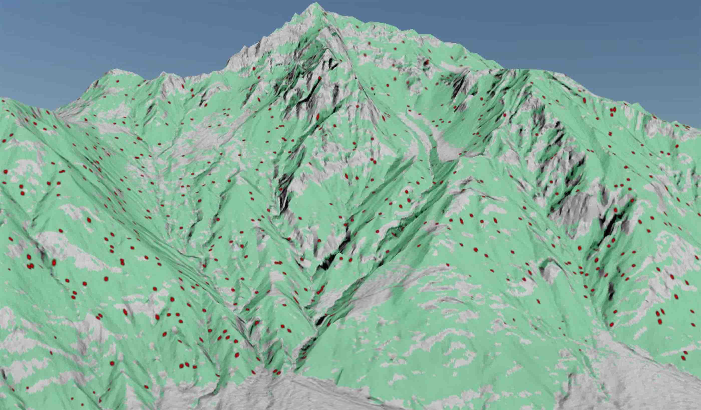
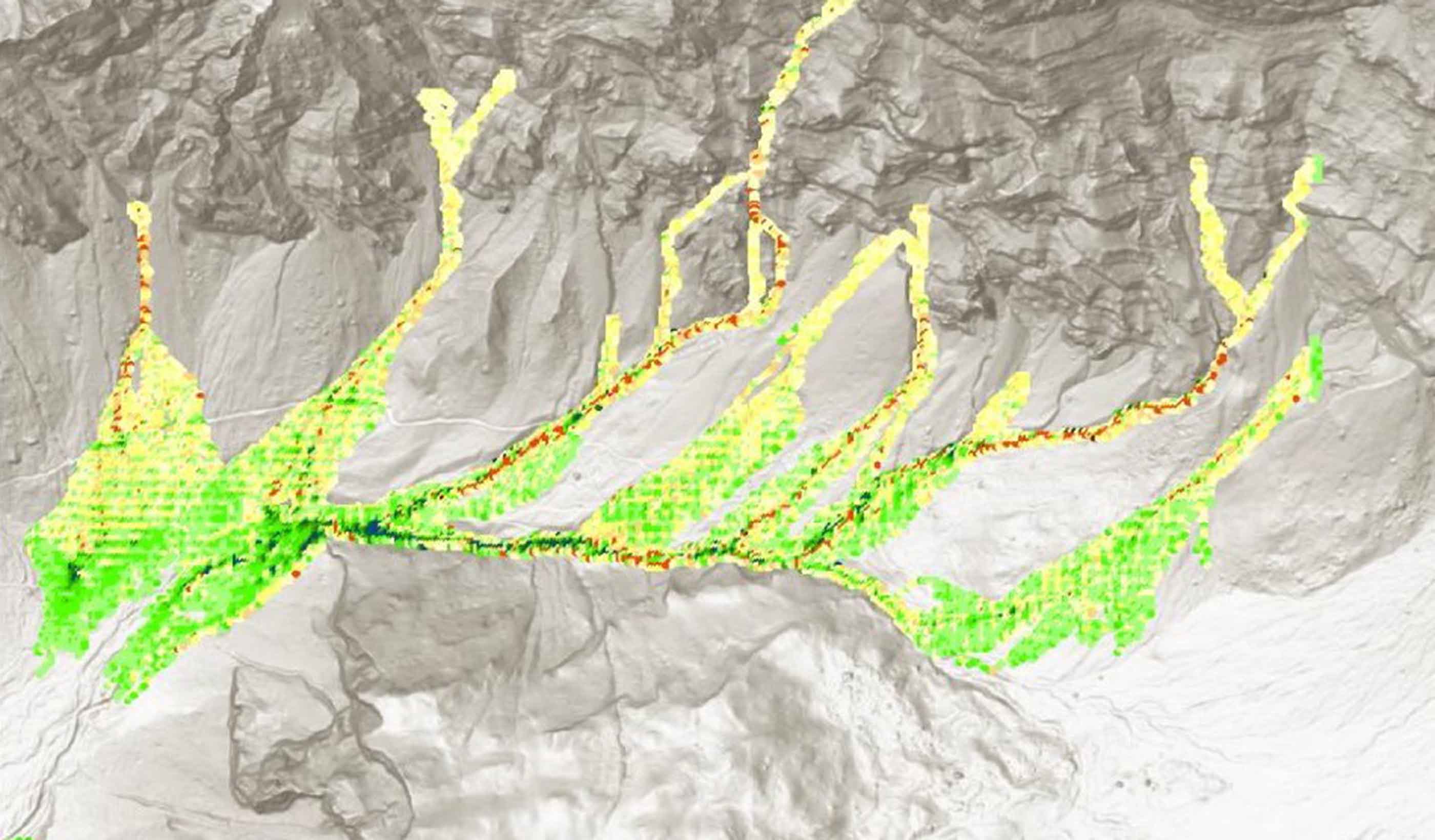
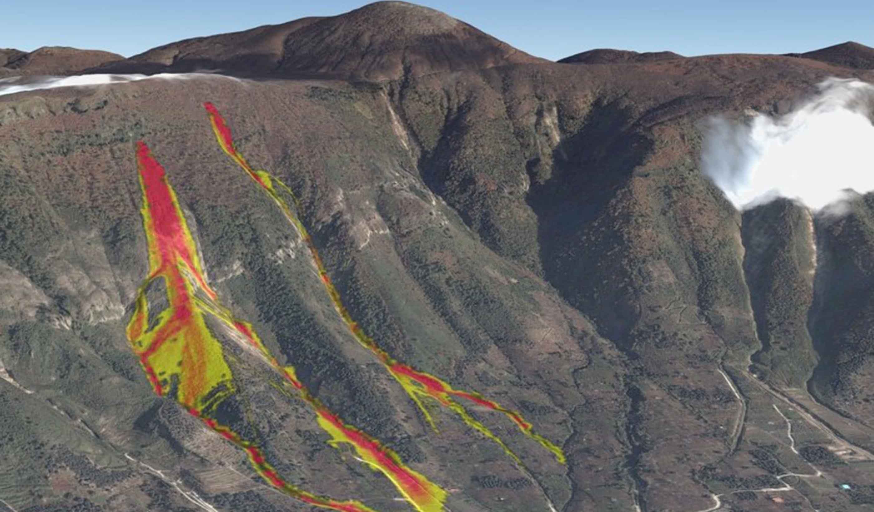
Stantec’s Dr. Rick Guthrie, Dr. Thad Wasklewicz, and Graham Knibbs present how often linear infrastructure, including rail, highways, and pipelines, span large geographic areas intersecting a variety of terrain, predisposing infrastructure to a higher likelihood of geohazard interaction. DebrisFlow Predictor (DFP) is a shallow landslide runout software that provides probabilistic spatial outputs of deposition and scour along a simulated landslide path. The path, or rather simulated runout, is produced by agents interacting with the topographic conditions of a 5-metre digital elevation model (DEM), and other surrounding agents in the model environment.
New methods for remotely assessing hazard are becoming available as processing capacity and higher resolution data become readily accessible. The approach of utilizing a novel agent-based model, such as DebrisFlow Predictor, in such a manner has enabled the quantification of probabilistic hazard results across widespread regions with modest limitations and arguably astounding visual aids in support of communicating results.