Remote sensing, 3D mapping help find answers in Tulsa
February 07, 2025
February 07, 2025
Alex Badillo talks to Esri’s ArcNews about how archaeologists used remote sensing and 3D mapping to investigate a 1921 massacre in Tulsa, Oklahoma
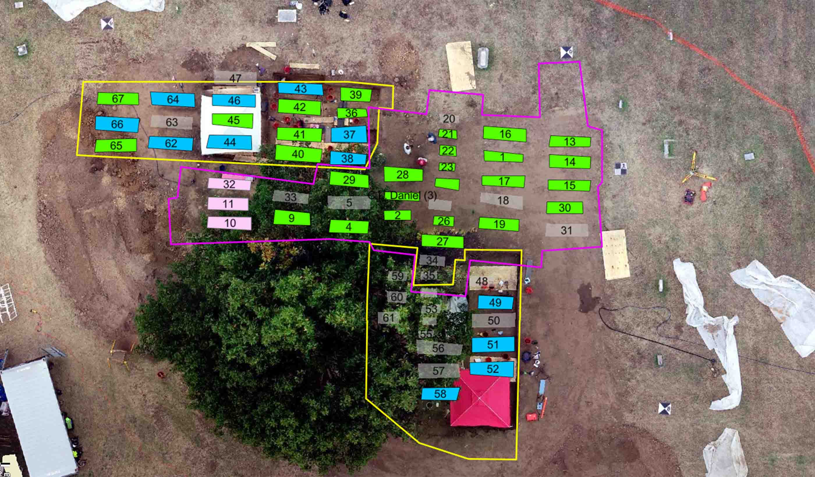
Nearly two dozen Stantec archaeologists, including Alex Badillo, are helping investigate one of the nation’s darkest moments using remote sensing and advanced Geographic Information System (GIS) technology. In 1921, a mob attacked Tulsa’s thriving African American neighborhood of Greenwood, known as Black Wall Street, destroying 1,000 homes and businesses. An estimated 30 to 300 people died. How many died is a mystery because the victims and their identities are still largely unknown. The records that do exist suggest some victims were buried in a segregated area of Oaklawn Cemetery known as Section 20.
Archaeologists spent the summer of 2024 excavating Section 20. Badillo, the project team’s digital archaeologist, is building a geographically accurate 3D model of Section 20 to help the investigation. Badillo tells Esri’s ArcNews that the digital processes used in the project are a “novel, modern framework for archaeology.” The GIS publication tells the story of investigating Section 20 with innovative mapping technology.