How water utilities can develop a digital twin and use GIS mapping to meet future needs
June 06, 2023
June 06, 2023
How to help the Jackson, Mississippi, water crisis? Using GIS to map the water distribution system and create a digital twin.
In Jackson, Mississippi, residents have been frustrated for years as their water distribution system lets them down. It has struggled to meet basic needs for reliable, safe drinking water.
The water system in Jackson is notorious for its poor reliability and lack of consistent water supply. Parts of the system are old and poorly maintained. The city has seen years of struggle when it comes to dependable water service. The newly formed JXN Water, LLC, is working to improve the aging water distribution system.
Part of the solution? To help improve Jackson’s drinking water crisis, several members of our Water and Water Geospatial teams are working on a huge geographic information system (GIS) project. The water distribution system in Jackson, which serves around 150,000 people as well as business and industry, doesn’t have a GIS in place.

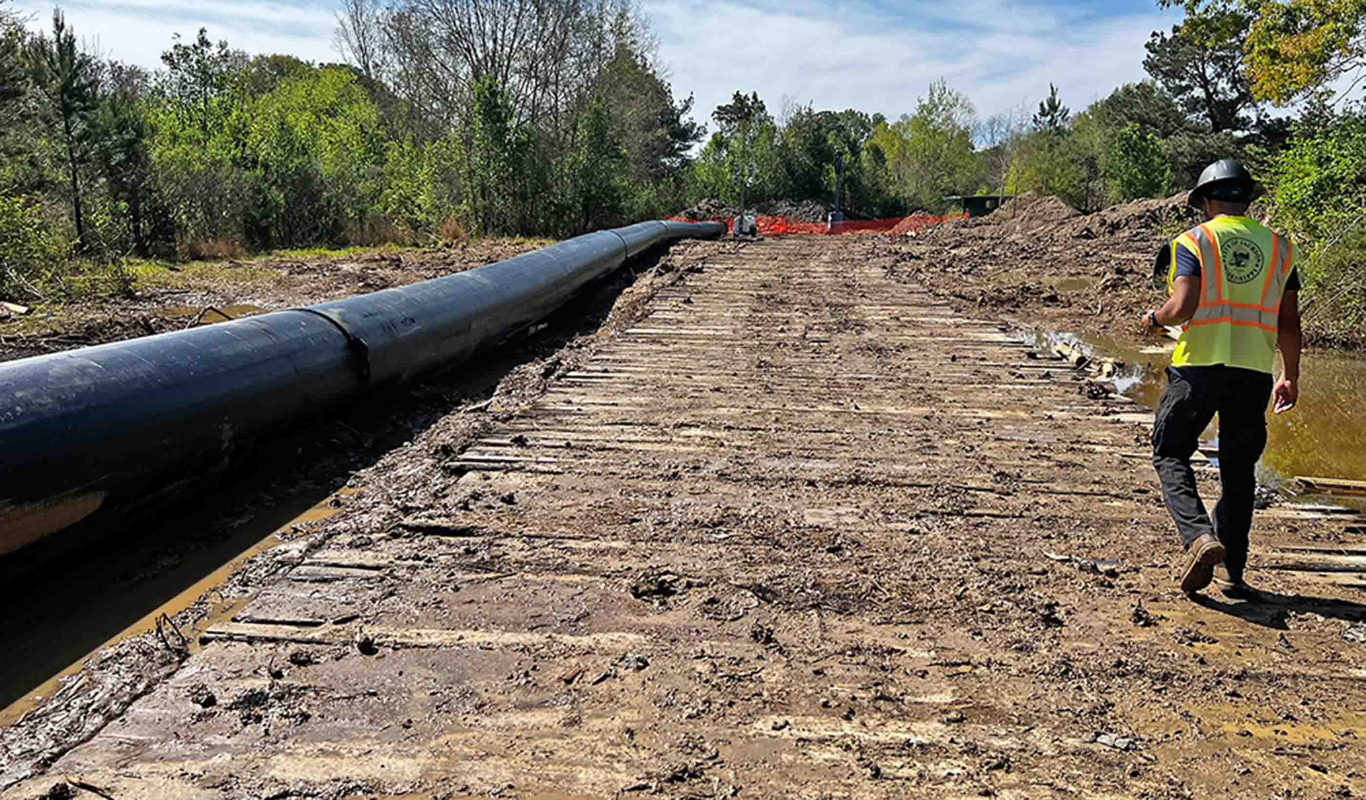
Work is underway to repair the water distribution system Jackson, Mississippi.
That means we’re building a GIS-powered digital twin (a virtual replica of physical assets) from scratch. It’s an opportunity for our experts to build a best-in-class utility GIS for a city that desperately needs an effective, modern solution.
It’s hard to manage water utilities properly without the GIS information. A digital twin can provide that, along with location-based, spatial context. This offers endless options for analysis and insight into the data. Many water utilities already have a well-designed GIS, meaning their assets (including water distribution systems) are digitally mapped. But quite a few utilities need updates.
At the outset of our GIS work in Jackson, we’ve discovered the available water asset information is far from modern. It’s limited to more than 10,000 historical record drawings. Some of these date back to 1903. Many of the drawings we’ve seen were originally hand drawn and eventually scanned with varying levels of legibility.
We have more than 15 people from our Geospatial team who are reviewing, georeferencing, and digitizing each drawing. This process requires the use of publicly available GIS data, which includes aerial imagery, street centerlines, and parcel boundaries. The team determines the spatial location and attributes of each asset shown in the drawing.
All the physical work a water utility performs—from maintenance, repairs, and replacing meters, to identifying upgrades—depends on where that work is located, what it does, its age, material, size, and work history. GIS is incredibly effective for operating, managing, and improving these assets that aren’t visible from above ground. It can help a utility build an operational picture of its system—most of it hidden from sight and spanning many square miles. (In Jackson, it’s over 100 square miles).

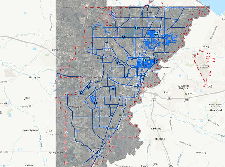
The current state of the City of Jackson’s water distribution system and service area, as shown within the ArcGIS Utility Network.
With GIS in place, operators can manage, model, and operate their entire system from the plant, the field, or in the office. There are other uses, like asset management, operations and maintenance, capital improvement plans, engineering, design, and hydraulic modeling.
Many water utilities are seeing greater demands on their GIS. That’s why we’re helping more of them develop GIS-powered digital twins. For example, in Collier County, Florida, we’ve recently designed and deployed GIS databases, created GIS web services to power its asset management program, and piloted new tools to help the county meet increasing demands placed on its GIS. All of this comes as the utility transitions to an asset management-centered approach to operations.
We’ve worked with Collier County for 15 years to support its utility GIS for water, wastewater, and reclaimed water systems. This GIS can be used in multiple business processes for the utility. And it can support the growing analytical, modeling, and asset management needs of the future.
Residents and businesses are at the heart of every city and town. They rely on their water utilities to deliver a stable, reliable water supply.
Water utilities also face more budget pressures as infrastructure ages. It means they must be smart with their limited dollars. Having a modern GIS allows for more informed, efficient decision-making and capital improvement planning.
Even utilities with an existing GIS may want to review it. Why? Look and see how closely it mirrors reality as industry tools and solutions rely on it more. It’s hard to perform accurate analysis and make reliable predictions if the information you’re using isn’t precise.
Jackson is a rare situation where there is no existing GIS or digital twin.
In most other cases, utilities with water distribution systems of this size already have a well-established GIS. But as they plan to update or replace existing assets, they need to stretch their dollars and apply them to assets that deliver the highest return. This requires accurate data that represents the connectivity of their system, the importance of their assets, their condition, and their age. Many existing utilities will have to determine whether their GIS can meet those needs, and if not, look at how it can get there.

A water tower in Jackson, Mississippi.
Our team is helping utilities maintain and modernize their GIS across the US. We’ve worked with Los Alamos County, New Mexico, for the past six years to support its water, wastewater, and natural gas utility systems. There, a system of record for asset management is closely linked with the financial system to provide both financial and risk values to assets through the entire lifecycle.
Cities running a water utility with GIS should consider the demands that they’ll face in the next 5 to 10 years. Can the current GIS meet those demands and provide the right information to make well-informed decisions? Can their GIS (and the systems built around it) get that information to the people and software that need it? Is the format easy to use, and can it be analyzed to answer these critical questions?
Residents and businesses are at the heart of every city and town. They rely on their water utilities to deliver a stable, reliable water supply. This holds true even as infrastructure ages, population changes, and demands on assets increase.
GIS-powered digital twins can help these utilities keep up with changing needs in the future and serve their communities seamlessly. So, now is the time to make the investment.