How satellite technology can monitor buried pipelines—and find leaks more quickly
December 12, 2019
December 12, 2019
PipeWATCH is a remote sensing technology—and it’s a game changer for the oil and gas industry
The solution to monitoring pipelines buried beneath the earth’s surface can be found in outer space. No oil and gas company wants a pipeline to leak. Aside from the potential effects on the environment, wildlife, and local communities, a contaminant release costs time and money, and can negatively impact a company’s reputation. That’s why companies must invest substantial time and money to constantly monitor pipelines.
While newer pipelines may utilize fiber optics and computational monitoring systems, it’s extremely difficult to retrofit older pipelines with that kind of technology. So, for pipelines that are already buried, companies often use ground patrols, either by ATV or foot, or fly planes over pipeline rights-of-way using pilots trained to visually detect a release. But those processes are labor intensive and incredibly expensive.

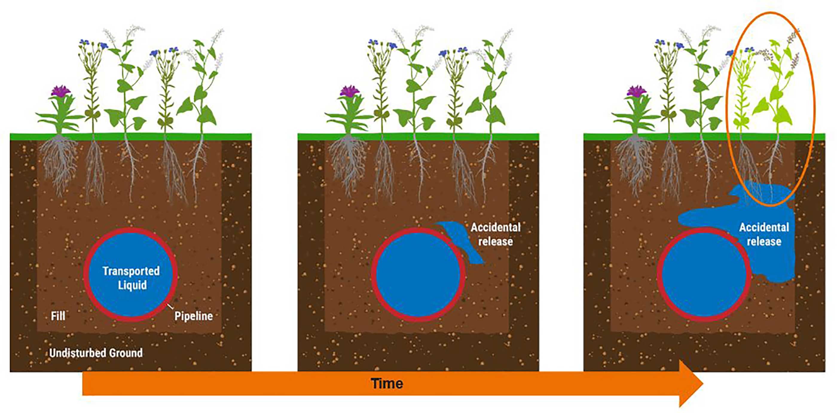
If PipeWATCH indicates a drop in the health of the vegetation, that raises a red flag. It could be due to a contaminant release.
But now, pipeline owners can look to the stars for help detecting contamination leaks. Stantec has developed a new technology called PipeWATCH, a remote sensing service that uses dove satellites to scan the earth’s surface and collect imagery daily. PipeWATCH is an industry game changer, because it’s not just a “Where” technology—it’s a “Where When” technology, one that lets you look at things in near real time—like the accidental release from a pipeline.
So, how exactly can a satellite help us know what’s happening with a buried pipeline?
Pipeline owners can look to the stars for help detecting an accidental release underground.
First, forget what you know about traditional satellites orbiting the earth. Those traditional satellites can be the size of a large SUV. Dove satellites are the size of a loaf of bread. They’re less expensive to manufacture and less expensive to launch. When launched in a constellation, these small satellites work as a team to achieve complete coverage of the earth. For PipeWATCH, we’ve partnered with the company Planet, the world’s leading dove satellite imaging provider for unprecedented image fidelity and low pricing.
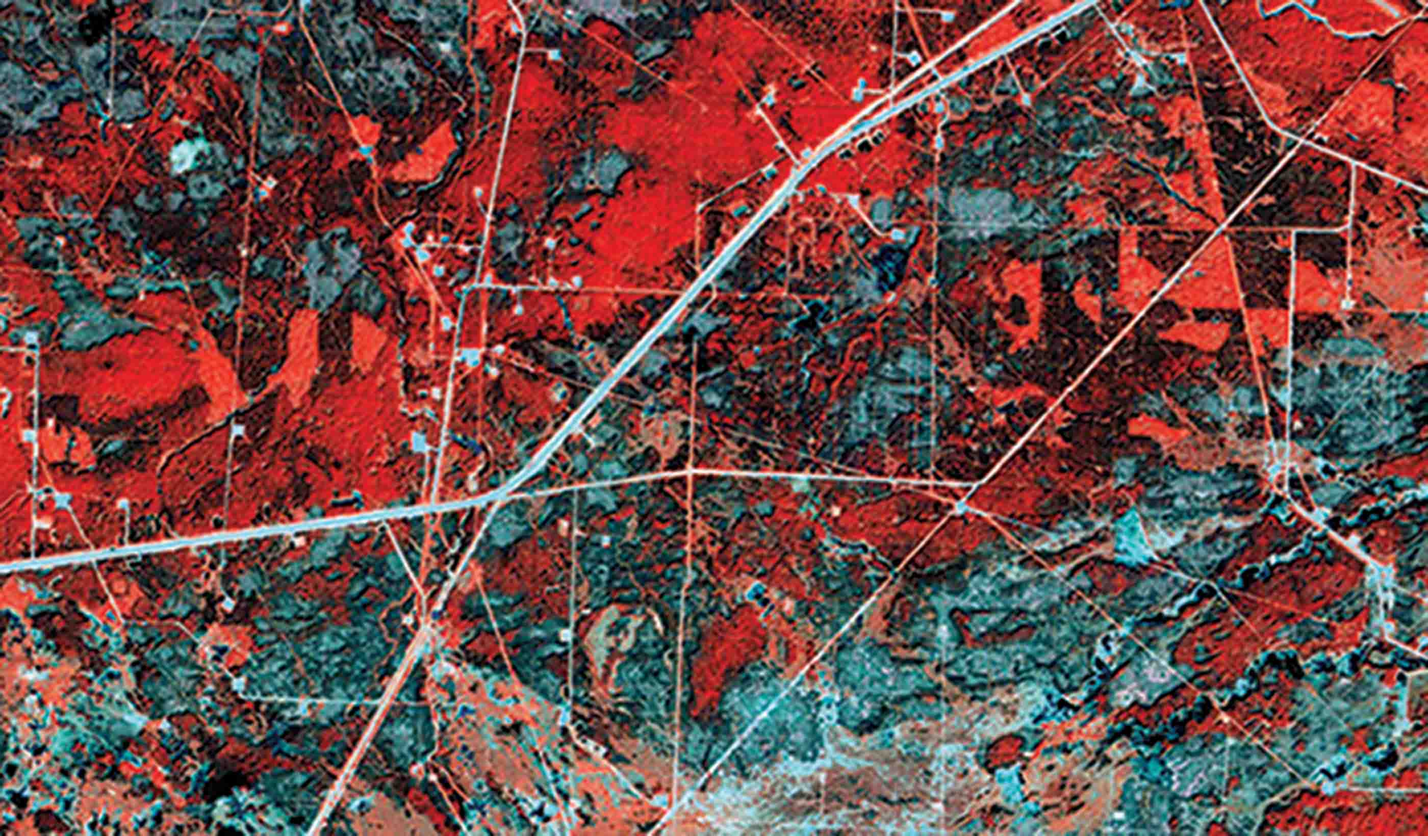
These small satellites collect RBG (red, blue, green) images as well as near-infrared images. Combined, these images can give us very detailed information about the health and vigor of any vegetation on the earth’s surface.
Using PipeWATCH, we download the images and calculate these vegetation indices. The next day when we scan that section again, we automatically generate vegetation health values and perform a change detection analysis. If we see a drop in the health of the vegetation, that raises a red flag. It could be due to a contaminant release.

PipeWATCH acts as an early detection system by regularly assessing pipeline rights-of-way for release events.
Another benefit of PipeWATCH is the dove satellite constellation acquires your pipeline right-of-way imagery and continually stores the data. All day, every day. With that stored data, you can even go back and perform a change-detection analysis on a section in retrospect. You certainly can’t fly a plane back in time to observe an area in the past.
And going back in time is exactly what a potential PipeWATCH client asked us to do. It was an intriguing challenge. The client was interested by PipeWATCH, but they needed a proof of concept study. This client had experienced a pipeline spill somewhere in an area 625 km2 in size earlier in the year. That’s all they told us. No infrastructure, no right-of-way information provided. They asked us to use PipeWATCH to review the data from a 4-month window and see if we could determine exactly when and where the spill had occurred—and if we could identify it before they had.
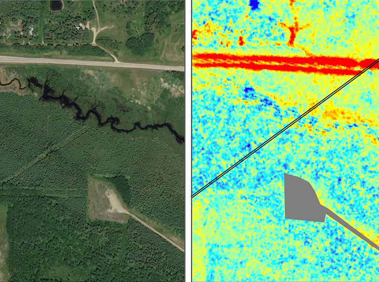
By analyzing the satellite images and running the highly sensitive vegetation change detection analysis, PipeWATCH determined the location of the release and when it started. Our client verified PipeWATCH had found the correct site and admitted that PipeWATCH discovered the leak five days prior to their knowledge. Had they used PipeWATCH, they could have caught the release five days earlier and perhaps saved millions of dollars in lost production and clean-up costs. The earlier you catch a release, the greater the environmental and economic benefit. And catching a spill faster can reduce your rehabilitation costs and minimize negative publicity.

PipeWATCH can quickly help mitigate surface and subsurface releases by pinpointing exact locations of concern.
Consider this: The most common method for monitoring a pipeline RoW today is to have a pilot looking for visual evidence of a release. But a pilot needs visual confirmation at the surface. A human’s vision simply cannot compete with the near-infrared scan of a satellite. The pilot also has nothing to reference while looking for a change. Everything PipeWATCH does uses highly sensitive vegetation indices, scientifically repeatable change detection resulting in quantifiable data—all unavailable to pilots. And what if you have a pinhole-sized leak that builds up slowly and gradually? It’s unlikely that pressure sensors will pick it up. But, over time, that contaminant buildup will leach into the roots of surface vegetation. PipeWATCH’s change detection analysis will see that degradation, helping us catch small leaks and patterns of degradation that are still underground.
As we move into the future, pipeline infrastructure will continue to age—while the dove satellite technology at the heart of PipeWATCH continuously improves. Just two years ago, we were able to use our satellite constellation to monitor the earth’s surface to a resolution of 10 meters. Today, we use 3 meters. By 2022, the technology will enable us to look even closer—to a resolution of just 25 centimeters.
The benefits are obvious, from conservation, to economics, to health and safety. With PipeWATCH, the future of release detection is now.